By Amy Butler, Florida Atlantic University
While summer is typically a time to kick back and relax in most parts of the country, Floridians don’t always enjoy the same easy-going, care-free attitude as their northern neighbors. As temperatures heat up, many Floridians go on high alert in anticipation of another hurricane season.
This year, U.S. Atlantic and Gulf Coast residents are bracing for what could be an unprecedented 2024 Atlantic hurricane season. While June 1 marked the official start of hurricane season, the date also ushered in the very likely arrival of La Niña conditions, removing nature’s “brake” on hurricanes. A La Niña weather pattern combined with unusually warm waters in the Atlantic Ocean provide prime conditions for a supercharged hurricane season.

“Overall, this year is forecasted to be a very active year due to a high chance of La Niña’s condition in late summer,” stated Yijie Zhu, Ph.D., an assistant professor in the department of geosciences in the Charles E. Schmidt College of Science at Florida Atlantic University. “A low wind shear and higher-than-normal sea surface temperature environment is favorable for hurricane formation and intensification. For the Atlantic Ocean basin, hurricanes during La Niña are usually more active than in El Niño years.”
As of July 9, forecasters predict a total of 25 named storms, of which 12 will reach hurricane strength during the season, which runs through Nov. 30. Researchers expect that five of the 11 hurricanes will reach major hurricane strength (Category 3 or higher) with sustained winds of 111 mph or greater.
In the past 40 years, hurricanes along the Atlantic coast have become stronger faster, an occurrence known as rapid intensification. Studies have found that climate change is creating more favorable conditions for hurricanes to strengthen more quickly, especially due to record-high surface ocean temperatures.
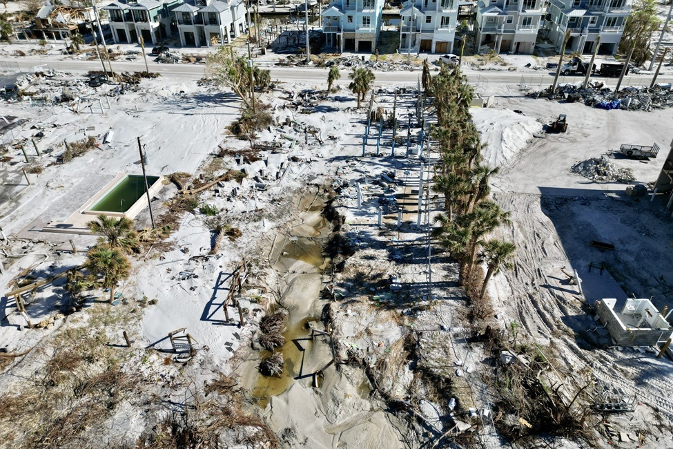
When storms strengthen rapidly, it becomes difficult for scientists to predict how severe a storm might become. Residents could have less time to prepare or evacuate, cause massive economic damage and destroy critical coastlines.
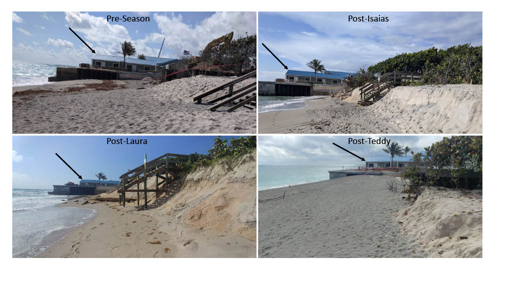
“High-intensity storms bring strong winds and large waves that can cause severe coastal erosion and damage structures and infrastructure, such as homes and roads,” explained Tiffany Roberts Briggs, Ph.D., chair, associate professor and director of the Coastal Studies Lab in the department of geosciences in the Schmidt College of Science. “When coupled with storm surge, the impacts can be devastating. This is problematic because many coastal communities are densely populated, such as here in South Florida. That means storms have the potential to disrupt many people’s daily lives with environmental, economic and structural impacts, and in some cases even pose the risk for loss of life.”
Due to its unique geography, Florida is the most hurricane-prone state in the country. Florida has the second-longest coastline in the United States, behind Alaska, totaling 1,350 miles. The peninsula juts into the Gulf of Mexico and the North Atlantic, leaving it exposed to storms from both bodies of water.
Stronger hurricanes also bring drastic flooding. When air temperatures are warmer, the atmosphere has a higher capacity to hold water. In one of Zhu’s previous studies, his team found that found that hurricanes are decaying slower inland when compared to 30 years ago. This means more inland regions were affected by hurricanes, not only by wind, but also by rainfall. Other studies have shown that hurricanes are moving slower in recent decades. This means hurricanes could stay longer over a city (e.g., Harvey in 2017) and bring double or triple amount of rainfall, causing extensive flooding.

“Many large-size tropical storms or hurricanes could remain a portion of the system over the ocean while moving inland, that could result in a very weak intensity decay even after making landfall,” stated Zhu.
Experts encourage new and seasoned residents alike to make and follow a hurricane plan now and have appropriate supplies ready. Floridians should also get to know their evacuation zones and make arrangements to stay in a safe and secure location that is outside the evacuation zone.
“People living along the coast, especially in South Florida, should take caution and prepare for hurricane season,” stated Roberts Briggs. “Storms can be unpredictable, and conditions can change rapidly before landfall. It is best to be ready and have a plan in place for informed decision making.”
FAU has experts available to speak to media or the community about various issues surrounding hurricane preparedness, evacuation and aftermath.
Links to local, state and federal resources and recommendations:
- Florida Disaster: Division of Emergency Management
- Palm Beach County Hurricane Planning Guide
- Broward County Emergency Management
- Know Your Zone: Florida Disaster: Division of Emergency Management
The FAU Center for Environmental Studies manages and the FAU Charles E. Schmidt College of Science provides support for The Invading Sea. This piece was originally published at https://www.fau.edu/science/news/fau-experts-predict-a-highly-active-2024-hurricane-season/.
Sign up for The Invading Sea newsletter by visiting here. If you are interested in submitting an opinion piece to The Invading Sea, email Editor Nathan Crabbe at ncrabbe@fau.edu. To learn more about storm surge, watch the video below.


